
The sewer plan is not a unique document: depending on the community, it can be an excerpt from the sanitation zoning, a record plan after work, or a GIS layer exported from an open data portal. Before contacting a technical service, it is essential to identify which of these documents corresponds to the actual need (connection, extension, pre-sale diagnosis).
GIS Georeferencing and Interactive Digital Plans of Sanitation Services
Several communities now publish their collection networks in the form of freely accessible GIS layers. For example, Angers Loire Métropole provides on its open data portal the georeferenced layout of the wastewater collection network, including access points, connections, and nominal diameters of the pipes.
You may also like : How to Hack a Facebook Account Step by Step: Complete Guide and Tips
This type of interactive plan allows for zooming in on the parcel, identifying the nearest main collector, and measuring the distance between the property line and the connection point. We recommend systematically cross-referencing this data with the municipality’s sanitation zoning, as a section visible on the GIS map may belong to either a combined or separate network, which alters the connection obligations.
Not all metropolitan areas offer this level of detail. When the open data portal does not cover your area, requests should be made to the sanitation service of the town hall or the competent intermunicipality. The response time varies, but most communities handle these requests within a regulatory framework related to the right to access administrative documents. Obtaining a precise sewer plan and pipelines remains the first step before any intervention on the network.
Related reading : How to easily find a person's name from their address?

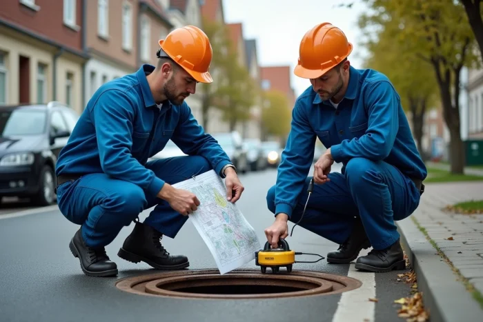
Cast Iron Pipes Installed Before 1980: Why Ground Penetrating Radar Replaces the Classic Probe
On networks installed before 1980, uncoated gray cast iron undergoes corrosion that degrades the electromagnetic signal. A classic location probe, which emits a traceable signal from the surface, loses reliability when the pipe wall is graphitized. The displayed layout can deviate by several tens of centimeters from the actual position.
ASTEE documented in a case study published in April 2026 a rise in DIY location failures on these old networks. Professionals now recommend using ground penetrating radar (GPR), which detects discontinuities in the subsurface regardless of the material’s conductivity.
GPR produces a cross-sectional profile of the ground. It identifies the trench, the bedding, and the pipeline itself, including those made of sandstone or non-metallic PVC. However, it requires an operator trained in interpreting radargrams. An individual cannot reliably operate this equipment alone.
When to Prefer GPR Over a Camera Inspection
Camera inspection provides the internal condition of the network (cracks, roots, joint misalignments) but not its precise geographical position. GPR locates the pipeline in the horizontal plane and at depth, which is the required data before excavation or foundation placement.
We observe that both techniques are complementary: GPR positions the layout, while the camera assesses the structural condition. Ordering both simultaneously reduces travel costs and provides a complete technical file for a building permit or sanitation diagnosis.
Reading the Record Plan: Elevations, Water Lines, and Access Points
The record plan is the document established after the actual installation of the network. It differs from the project plan, which represents an intention. Only the record reflects the layout actually executed, with site adjustments.
This plan includes several technical details to verify before any connection:
- The elevation of the water line (lowest internal point of the pipeline) at each access point, expressed in NGF meters. This elevation determines whether a gravity connection is possible from your building or if a lift station will be necessary.
- The nominal diameter and material of each section (PVC, cast iron, sandstone, concrete), which determine the type of tapping allowed by the network manager.
- The location of access points and connection boxes. The access point at the property line marks the boundary between the public network and the private network: maintenance upstream is the owner’s responsibility.
- The slope of the collector between two access points, which indicates the flow direction and the residual capacity of the section.
If the record plan does not exist (old subdivisions, rural areas), the community can provide a sanitation zoning plan that indicates only whether the parcel is in a collective or non-collective sanitation zone, without the precise layout of the pipes.
Non-Invasive Detection by Hydro-Vacuuming: An Evolving Field Method
The FNTP reported in its 2025 annual report a growing trend in detections using hydro-vacuuming. The principle: a high-pressure water jet disaggregates the soil around the pipeline, while a suction system evacuates the debris in real-time. The pipe is exposed without an open trench or risk of breakage.
This technique is particularly suitable for dense urban environments where the subsurface contains multiple networks (drinking water, gas, telecoms, wastewater, stormwater). It allows for visual confirmation of the position and condition of a connection before linking, where GPR only provides an indirect image.
Limitations of Hydro-Vacuuming
The intervention cost remains higher than simple electromagnetic detection. Hydro-vacuuming is justified when precise location is critical for imminent excavation, for example, to install a foundation less than a meter from a presumed collector. For a simple layout verification during the study phase, the combination of GIS plan and GPR is sufficient in most cases.
The choice of method therefore depends on the project’s stage and the reliability of the available documents. A recent and georeferenced record plan often makes any field detection unnecessary. Conversely, the absence of a reliable plan for a network installed before 1980 directs towards GPR as the first option, supplemented if necessary by localized exposure.